
Ruston ZIP Directory Coverage
Official sources group three ZIP codes under the Ruston postal name, but they do not publish a complete street-by-street polygon for all three. The State Library directory and Lincoln GIS identify 71270 as the primary Ruston ZIP. The USPS label list groups 71270, 71272, and 71273. That is postal evidence, not proof that every address lies inside Ruston.
| ZIP Code | Areas Covered | Post Office | Notes |
|---|---|---|---|
| 71270 | Ruston general city and postal area; GIS includes it | Ruston Post Office, 700 E Georgia Avenue | Primary Ruston ZIP; exact street polygon not verified |
| 71272 | Ruston grouping in the USPS label list | Ruston postal name | Exact delivery or institution footprint not published |
| 71273 | Ruston grouping used by official municipal and parish PO boxes | Ruston postal name | PO-box pattern observed; no exclusive designation claimed |
The USPS FAST list inspected was effective August 1, 2025. Municipal and parish offices often use 71273 for mail, while many street addresses use 71270. No source verified a ZIP split year or a unique-institution designation for 71272.
Find Ruston Residents by ZIP
There is no official anonymous roster of every resident in one Ruston ZIP code. ZIP data narrows a search within a specific system. GIS exposes ZIP and community fields. The voter portal accepts ZIP with an exact address. The assessor advertises address search, but its unauthenticated controls were blocked. eClerks is built around parties, dates, and record sets rather than ZIP.
- Verify the delivery code with USPS by full address, city and state, or ZIP-to-city mode.
- Check the Lincoln GIS ZIP and municipal-boundary layers, then save the mapped address and parcel ID.
- Use an exact eligible address in the voter portal, including apartment or lot when needed.
- Move from ZIP to street and compare a named assessor, deed, court, or other official record.
- Record whether each value came from USPS, GIS situs, assessor mailing, voter residence, or a PO box.
Once the postal area is reduced to a road, use the Ruston street directory for the address-level chain. That keeps a broad ZIP match from becoming a household claim.
Ruston ZIP Labels at USPS
The USPS label list is the best source for the official Ruston grouping and its effective date. It connects 71270, 71272, and 71273 to the Ruston name without making claims about municipal jurisdiction or residents.
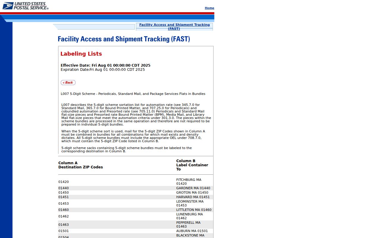
The image confirms which codes share the Ruston postal label. It does not draw city limits or identify who receives mail there.
Ruston ZIP Fields by Portal
Each system gives ZIP a different meaning. USPS returns a delivery convention. GIS maps a field tied to an address or polygon. Voter search uses ZIP with more exact residence terms. A ZIP-capable field is not the same as a ZIP-wide people search.
| Portal | ZIP Mode | Other Fields | Limit |
|---|---|---|---|
| USPS ZIP Lookup | Address, city/state, or ZIP-to-city | Street, unit, city, state | Does not confirm a person or company |
| Lincoln GIS 911 layer | AdrZip5 and Zip | House number, street parts, community | Map data are not legal certification |
| Louisiana Voter Portal | ZIP in address route | Address, apartment or lot, city | Not an anonymous ZIP roster |
| Assessor/DataScout | Exact ZIP control not verified | Owner and address search advertised | Form blocked in inspection |
| eClerks | No ZIP field in captured guide | Name, date, match, record set | Party-oriented search |
Keep the field label with the result. An assessor mailing address may differ from GIS situs, and neither should be silently substituted for voter residence.
The parcel schema adds context that a ZIP field cannot supply. AdrLabel and AdrZip5 describe the mapped site, while MailingAdd belongs to the owner's mailing field. ParcelId and CAMAKey identify the parcel; subdivision, section, tax area, and legal-description clues place it in land records. Compare these fields before deciding that two Ruston rows describe one place.
For reproducible map work, save the layer number, query date, chosen output fields, and whether geometry was returned. The ArcGIS interface supports text or where clauses, object IDs, geometry and spatial relationships, ordering, statistics, and several output formats. Those controls can isolate ZIP-tagged features, but GIS remains a duplicate map product rather than a certified boundary or survey.
Read Ruston ZIP Address Fields
The Lincoln Parish ArcGIS service documents a 911 address layer with house number, street parts, ZIP, community, and revision fields. Its parcel layer adds owner, mailing address, parcel ID, subdivision, section, values, and tax-area data. Together they distinguish a postal label from a mapped structure.
The Lincoln GIS address layer exposes that schema.
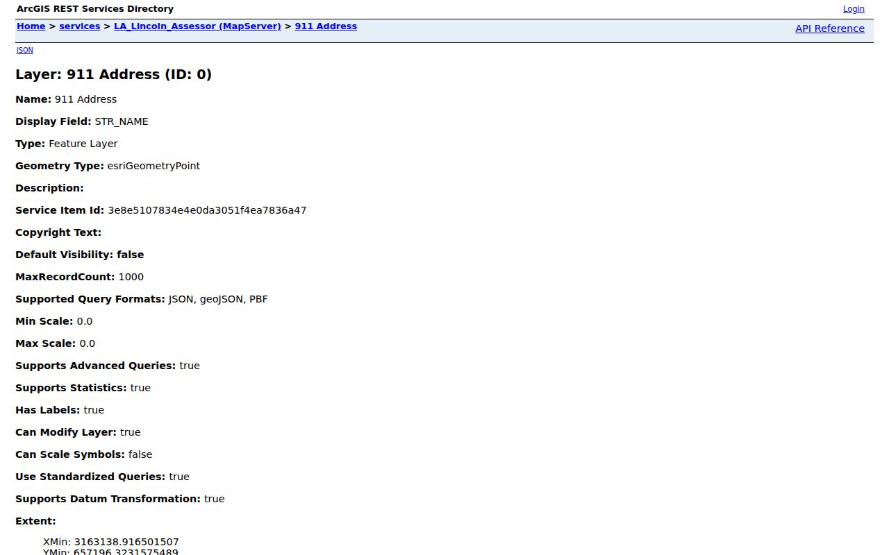
The layer supports research, yet the parish warns that cooperative GIS data are a duplicate map product and not a survey or legal decision.
New Ruston 911 Address Records
Lincoln Parish GIS assigns 911 addresses. Its FAQ says staff GPS the structure, measure to the nearest intersection, calculate the number, call the applicant, and mail an official notice. The typical process is 24 to 48 hours. Outside a municipality, an applicant may need a building permit and a filed Clerk legal description.
The dedicated 911-addressing page said “Coming soon” during inspection, while the FAQ gave the working process.
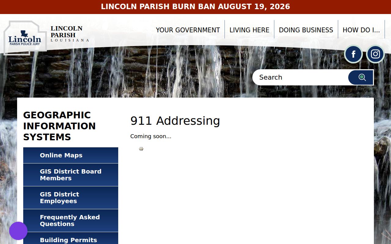
This mismatch means a call to GIS can be more useful than the landing page when a new address or ZIP is disputed.
Separate Ruston Address Types
A situs address is where the parcel or structure is mapped. An assessor mailing address is where tax notices go. A legal description identifies land through a subdivision, lot and block, section and township, or metes and bounds. USPS supplies the postal form. Voter residence follows election rules. One Ruston record can hold several valid addresses at once.
When an old number changes, save old and current street spellings, parcel ID, CAMA key, subdivision or lot, legal description, and map point. No verified Ruston renumbering or annexation chronology was found. A legal description is often the best bridge across a changed postal label.
Lincoln Parish ZIPs Beyond Ruston
The parish ZIP layer also returns 71001 Arcadia, 71225 Calhoun, 71227 Choudrant, 71234 Downsville, 71235 Dubach, 71245 Grambling, 71270 Ruston, and 71275 Simsboro. Only 71270, 71272, and 71273 are treated as the Ruston postal group in this ZIP code directory. A Lincoln Parish search must not collapse every community into Ruston.
The Lincoln Parish ZIP layer exposes the map metadata. GIS is a visual start, but it cannot certify title, jurisdiction, or delivery.
This parish-wide view matters near community and municipal edges. A postal city name is designed for delivery, while the municipal-boundary layer describes city jurisdiction and the parcel layer supplies the land unit. Keep all three labels when researching a Ruston address. If they disagree, report the mismatch instead of forcing the address into one geography.
A newly assigned 911 number may reach GIS before every other record updates. Preserve the official notice and revision field, then compare USPS, assessor, voter, and permit records on their own dates. The research found no verified Ruston annexation or renumbering chronology, so changed labels need this record-by-record bridge.
Ruston ZIPs Versus City Limits
A ZIP code follows mail operations, while a municipal boundary decides city jurisdiction. The State Library separately lists Woodville with 71270 in Lincoln Parish. That proves 71270 is not a certificate of location inside Ruston. Lincoln Parish also includes several cities, towns, and villages whose records must not be collapsed into one postal label.
- ZIP versus ZIP+4
- A ZIP routes mail broadly; four added digits narrow a delivery segment.
- PO-box ZIP
- A code used for post-office box delivery, though Ruston’s exclusive box codes were not verified.
- Unique ZIP
- A code assigned to one large recipient; no such Ruston designation is claimed here.
- Carrier route
- A mail route within a postal area, not a resident list.
Start with the GIS Municipal Boundaries layer, then verify mail through USPS and land through the Assessor or Clerk. None replaces the others.
Verify a Ruston ZIP Result
Record the full address entered, USPS result, retrieval date, and whether the value came from a parcel, voter record, PO box, or mailing field. This short audit trail stops a postal check from becoming a person-at-address claim.
The official Ruston Post Office listing gives 700 E Georgia Avenue and its 71270-9998 office code.
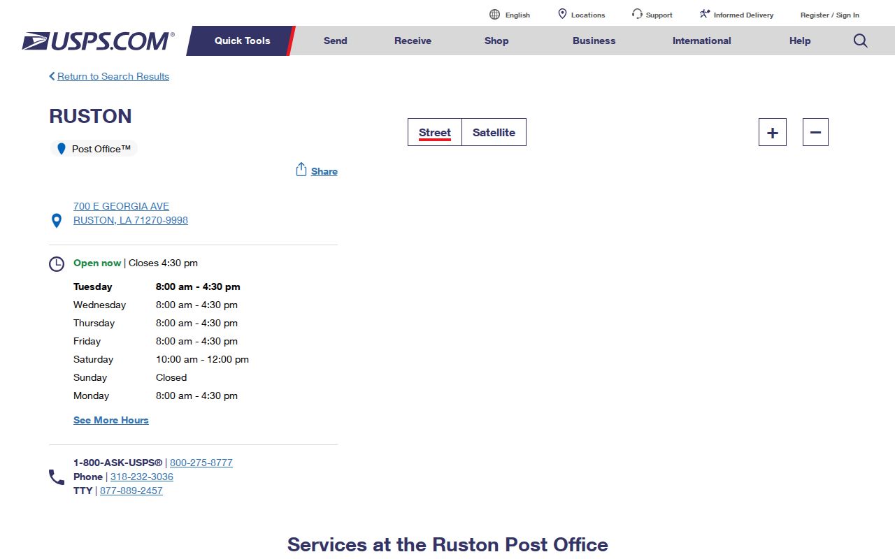
The page confirms the station and postal service point. It does not settle the city line or reveal residents.
Next, check the same address in the 911 and parcel layers. Record any difference among the postal ZIP, AdrZip5, owner mailing address, community field, and municipal boundary. Use the Louisiana voter portal only for its exact residence-address question. If the parcel or ZIP narrows the inquiry to one road, the Ruston street directory workflow explains the street-level chain.
For an office follow-up, give GIS the street number, road name, nearest intersection, map point, and filed legal description. Give the Assessor a parcel identifier or owner-and-address clue. Give USPS the delivery form exactly as entered. Each office can correct or explain only its own layer of the Ruston ZIP code directory.
Boundary check. Compare USPS delivery, GIS municipal limits, parcel situs, and legal description before calling any Ruston ZIP result a city address.